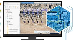
Understanding a Successful Migration to the Utility Network Model
Utilities have used geographic information systems (GIS) to manage asset data for years. Now the ArcGIS Utility Network presents a major opportunity to expand GIS capabilities and address previous limitations. Yet, many utilities are delaying migration out of concerns that it is too costly and difficult.
Completing a smooth migration presents undeniable challenges. Existing GIS architecture, data quality, and data structures must be evaluated to determine compatibility with the new system. Utilities must consider how migration will impact the workflows of map and data editors, as well as QA/QC processes. Third-party integration with GIS is another major concern.
What is sometimes overlooked is that delaying migration can create unexpected costs. Most utilities have created workarounds for GIS limitations, so it isn’t always obvious when a GIS solution no longer supports the business. But these shortcomings can reduce organizational efficiency and profitability, with significant ramifications.
Bad Data Undermines Efficiency
With existing GIS solutions, utilities often struggle to access timely, accurate data about their assets. Modeling, simulation, and project planning suffer as a result.
Models based on inaccurate or incomplete data produce bad simulations that generate misleading results. When utilities operate using these results, network functionality declines. Ruptured pipes, blown transformers, and excess pressure in natural gas pipes become more common. Repair crews may be sent to the wrong location. Usually, they can locate above-ground assets quickly, but they may waste hours finding the correct buried asset.
Bad data may cause stock levels in depots and on trucks to be wrong. This leads to dead inventory and emergency orders. Many utilities determine stocking levels based on historical usage, so the problem perpetuates.
Additionally, if asset health is estimated based on inaccurate data, maintenance or replacement may be prioritized incorrectly. New service requests will result in wrong costs and capacity available, or other mistakes.
Finally, "best guesses" and estimates are almost always based on highly conservative engineering, which can carry a higher cost.
Profitability is Threatened
Incomplete data also threatens a utility’s relationships with regulators and customers. Entering the wrong information on a regulatory filing or discovery question can cause permitting delays, a reduction in the capital spending allowed by the regulator, or other problems. Likewise, long delays in answering customer queries can lead to low customer satisfaction, bad orders for material, and incomplete or bad work orders for crews.
When a utility is seen as hard to work with because it takes too long to produce answers, potential new businesses may be hesitant to locate in that service territory. Existing businesses may choose not to expand use of the utility’s services and regulators may impose larger tariffs.
All of these factors impact a utility’s profitability and its ability to deliver needed services. Ultimately, the utility may be considered "too broken to fix." At this point, it risks being sold to another operator who is seen as having a better work ethic and culture. This fate has been encountered in the past by municipal utilities and investor-owned utilities (IOUs) alike.
A Better Alternative
The ArcGIS Utility Network model addresses data challenges that undermine efficiency and profitability in a number of ways. It enables more accurate modeling and clear representation of dense areas of the system. It enforces data integrity, provides advanced utility tracking and analytic capabilities, and is easily integrated with external systems through well-documented web services. Plus, the ArcGIS Utility Network model was built to scale easily for use by utilities large and small.
While it’s true that migration can be expensive and difficult, the investment pays off in greater organizational efficiency, improved asset use, and a reduction in wasted engineering hours. Planning ahead for the inevitable transition reduces both the challenges and the overall cost of migration.
A Little Planning Goes a Long Way
The first step in a successful migration is assessing the readiness of existing GIS architecture, data, data models, and workflows. It is also necessary to consider how the ArcGIS Utility Network structure will impact third-party integrations with GIS. Conducting a thorough review allows utilities to identify the areas within each category that will require the greatest level of effort for migration.
Utilities can then develop a migration road map that leverages existing efficiencies and achieves the full potential of the ArcGIS Utility Network model. For example, common goals include retaining all important information, identifying opportunities to leverage new GIS capabilities, building a model that is well-suited to the organization’s specific needs, and developing plans to manage change related to the migration.
To achieve the most successful outcomes, all planning should be conducted in the context of the complete project life cycle, including project planning, software installation and configuration, database design, data collection and data editing, custom application development, systems integration, and high-end analysis and data science.
Understanding the breadth and depth of the many issues that impact migration to the ArcGIS Utility Network model allows utilities to prepare for any software migration, staffing, or other challenges that may arise. Starting down this path as soon as possible pays off in both the short- and long-term.


