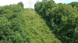
Utility corridors or right of ways (ROWs) provide elaborate and often interconnected green corridors considered by many to be valuable ecosystem-worthy green spaces. When managed properly, these areas may offer sustainable ground cover systems, improve biodiversity and provide suitable habitat for numerous species including pollinators.
Vegetation management in ROW corridors may include mowing, integrated vegetation management (IVM) and other tactics often formulated to subscribe to the primary objectives of safety and reliability. Evaluating the additional secondary gains in the worth of ecosystems after using prescribed management strategies is a good start in evaluating return of investment and benefits associated with these tactics.
Investing in IVM
IVM strategies, when in use, can play a major role in developing early successional habitat and enrichment of existing habitat. Recently, IVM benefits are increasingly being expressed as a measure of habitat value. Although this is a secondary objective in vegetation management, in many cases, it offers prime consideration.
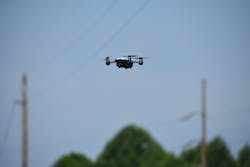
Expression of and quantification of IVM benefits may rely on standard ecological measuring practices assisted by a growing menu of technological tools. ROW vegetation imagery captured by drones and satellites, and strata analytics along with specialized software tools, may improve data collection and mapping and make the process more efficient.
Separation of ground cover and assessment of each layer from the low-growing under-wire early successional species, varying edge effects of trees in border zones and adjacent land use can provide a biological cross-section of the ROW and adjacent off-corridor areas. Strata analyses also serve to further evaluate the impact of plant cover and choice of management strategy on the habitat and pollinators like butterflies and bees.
At many ROWs today, the defensible and methodological investigation into ecosystems’ worth and habitat quality is currently occurring with increasing frequency. This is an encouraging development for us “green seekers → swipe right” and is aided in the rise of environmental stewardship efforts and such initiatives as the Monarch CCAA, Wildlife Habitat Council and the National Turkey Wildlife Federation etc. Artificially integrated ecosystem assessments in utility ROWs, such as the use of drone data and resulting strata analytics currently underway, can focus on habitat quality and IVM benefits.
AI Meets Environmental Assessments
Using drone optical imagery in ecosystem-based seasonal evaluations can improve efficiency of data collection and helps better define strata in the ROW under study after imagery is analyzed.
Strata defines the respective heights of vegetation and co-relates it with biodiversity estimates in each strata/layer. This AFM data, paired with resulting capture of invertebrate populations and other organisms as well as spot sampling and ground truthing, provides information unique to the relative height of the vegetation stratum and its relationship to habitat.
Evaluation of biological data including shifts in plant populations can be better explored in the short- and long-term. At a forensic level, pollen quality assessments over known periods can provide data useful for mapping high-impact pollen concentrations (pollinator value) per stratum in ROW. These artificial intelligence-enabled biological evaluations lead to the ability to measure and provide analytics of habitat quality with respect to management tactic and cycles.
When considering strata analysis or layers of vegetation type in a ROW, the plant constituent layer may be influenced by several factors including management strategy and adjacent land use. The following question becomes pertinent: How does the adjacent vegetation/ land use characteristics impact on pollinator presence and health?
While considerable variation exists in land use in adjacent areas in ROWs, when considering the tree component, ROWs can be divided into four land use characteristics/ types or in an ecological sense, habitat:
- No Trees in Border/Off Corridor Areas
- Trees in Border Areas (closer to wire zone but absent further out)
- Trees in Off Corridor Areas (none in border and further away from the wire zone)
- Urban Areas (some urban tree canopies)
Evaluating the Research
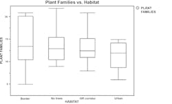
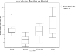
This question of the role of edge canopy trees in influencing under-wire habitat areas was explored at ROW sites nationally during April to October 2020. The analysis revealed that plant families did not vary with edge variation, however invertebrate families were significantly lower in samples taken from the ROWs with no edge trees.
This research data gives us a preliminary look into the edge effects and impact of edge vegetation on invertebrate and pollinator abundance the study will continue in the coming seasons.
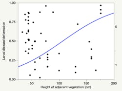
The second question addresses the impact of adjacent vegetation further along the strata pathway and asks: Does the density of milkweed plant stems and height of surrounding vegetation in IVM-managed ROW’s have an impact on monarch butterfly egg laying and visual health of the larvae?
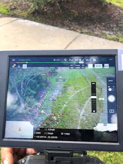
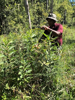
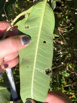
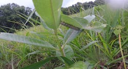
The research was conducted at several national ROW sites during May to August of 2020. Monarch butterflies typically lay a single egg on a plant, which prevents larvae from intra-specific competition or attacking each other for the same leaf and plant resource when multiple eggs are laid. Milkweed plants in polygons were mapped using ACRT-WMS after milkweed plants, growth stage and identifying groups were identified according to species and cluster size or stem density. Drones photographed the milkweeds, and optical imagery tools recorded growth stage, height and density along with visual ground counts.
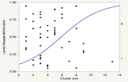
Through IVM, vegetation is maintained to a height conducive for sight, safety and clearance. Lower heights of surrounding vegetation polygons compared to milkweed plant groups and smaller clusters tend to have single egg placements, which prevent larval competition (hence in fighting and less cases of deformation of surviving larvae). Conversely, if surrounding vegetation polygons are higher than increased multi-oviposition and increased incidence of larval deformation, disease or parasitism occurs. When planning vegetation management and milkweed programs, shorter surrounding vegetation is encouraged. Milkweed stem density when kept to smaller densities or “fragmented polygons” of smaller groups may thus promote higher monarch survival.
Monarch Butterfly Larval Health
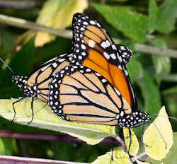
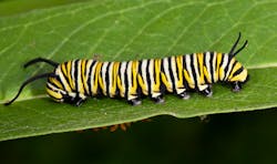
Monarch butterfly larvae had increased incidences of deformation, disease and parasitism when milkweed clusters were higher in density and height of surrounding vegetation was higher than milkweed cluster height.
This body of artificial intelligence integrated biological assessments represents ongoing research in ROWs that investigate utility corridor green spaces as habitat and assesses factors that may impact on that habitat. Further developing this science helps to continue to position practitioners and landowners alike to proactively manage for pollinators and other ROW wildlife. In particular, the following findings can assist in that effort:
- Edge effects may be observed in varying invertebrate populations in wire zone areas depending on presence and distance of trees from the wire zone.
- Polygons of Milkweed, Density and Heights of Clusters and Heights of surrounding Vegetation Strata: Monarch butterfly multi-oviposition frequency and disease, parasitism or deformation of larvae in common milkweed was highly correlated with increase in milkweed cluster density and increase in relative height of surrounding vegetation.
This novel finding improves the understanding of relative plant canopy structure and the association of milkweed plants with adjacent vegetation in ROWs in providing optimal habitat for Monarch butterflies.
Anand Persad, Ph.D., BCE ([email protected]) is the director of research, science and innovation for ACRT Services.
Editor’s Note: The author would like to acknowledge Stratigitech/Bermex – Tommy Combs and team for help with drone calibration research help; John Goodfellow, BioCompliance and Stan Vera Art, Grow With Trees, for overarching guidance; Samantha Mehl- University of South Carolina -Data and Field Support; Randy Miller from CNUC as an industry advisor and Rocha-KSU-Statistics ACRT Research Team.
