Satellite Data for Managing Vegetation Risk
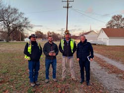
On a crisp, clear day in November 2020, a team gathered in Joplin, Missouri, to confirm what everybody hoped: that by using specially trained artificial intelligence (AI) to analyze satellite imagery, it would be possible to overcome the problems of scale confronting every utility vegetation manager: too many trees located over too many miles too far away.
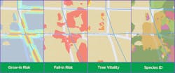
At that point in time, LiveEO had already done many field validations. Its Vegetation Management Insights program locates and measures individual trees, and its vitality monitoring module assesses tree health on three continents. During this project, however, the company was testing a new species identification technology to track seasonal changes in foliage and identify the genus. While this AI technology had yielded positive results in Europe, the data-hungry algorithm required extensive training when applied to a new environment. Rural Missouri, with its dense, high-variety forests, was a new playground.
Launching the Pilot Project
By using AI to analyze satellite imagery, the utility could infuse technological innovation into its vegetation management program. Liberty aimed to improve processes and gain efficiencies by taking a quick, reliable snapshot of vegetation conditions along the entire grid. In addition, the utility was also searching for a tool capable of prioritizing risks and generating work orders to tackle them.
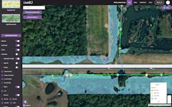
At the start of the pilot project, the team traveled to several areas of interest to inspect specific locations and validate the assessments made by the company’s Vegetation Management Insights solution. For example, they checked the information available in the app against what is known as the “ground truth,” or the reality on the ground.
During the project, the utility’s employees tested the mobile app in the field. For added reassurance, the app includes a feedback function by default, not just for validations, but also to allow contractors in the field to flag inaccuracies or errors. As the mechanism by which AIs improve themselves, feedback is critical to machine learning. Making it as easy as possible for users to provide feedback to the algorithms ensures the machine analysis gets increasingly more accurate every time it is used.
Evaluating Trees in Decline
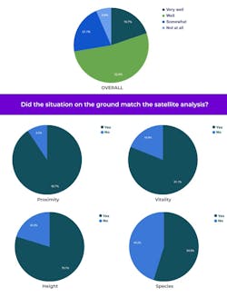
Height and location proved highly reliable for the most part. A few miscalculations occurred near steep embankments, but they were quickly rectified. The most challenging aspect was getting everyone to agree on the height of the trees. To provide guidance, an experienced field validator volunteered to step in as a human yardstick.
Traveling across the service territory, the team began evaluating trees flagged by the app as “in decline.” In several cases, the trees’ low vitality was obvious. These trees clearly needed some attention to eliminate the risk of an outage, and even an inexperienced ground patrol would have spotted them straight away.
This was not the case with all the trees in decline. With a satellite resolution of 50 cm, even minor limb dieback showed up. The team required a more in-depth visual inspection to confirm the vitality decrease picked up by the AI. Even so, it was beneficial to highlight these declines before the process began. The accuracy of the plant vitality and change detection highlighted changes that weren’t readily identifiable with the naked eye.
They may not have achieved perfect results, but they targeted areas for improvement. Because the model had performed so well on species it recognized from previous projects, it suggested it was a matter of calibration and training. LiveEO’s project manager defined the steps to improve the AI’s training on dense/high-variety woodlands like in Joplin, Missouri. For a start, they knew they had to double the length of their local species list.
Over the following months and a series of reruns, species identification accuracy improved in large steps. Seeing how fast the AI technology evolved and improved felt more exciting than the high accuracy the established modules had displayed. This was no regular tool Liberty was adding to its tool kit. This tool was self-improving, and it was a fast learner too.
Nick Ferguson ([email protected]) is vice president infrastructure at LiveEO GmbH, a company specializing in using AI to analyze data from earth
observation satellites. He is also the co-host of the CEU-accredited UVM Podcast which won the UAA’s Education Award in 2022. With bachelor’s and MBA degrees, he has an academic background and interest in the application of innovative spatial technologies to generate value for electrical utilities. He has worked alongside utilities with global exposure to best practices in the United States, Canada, Australia, the U.K., the Middle East, Africa and India.

