Using AI-Driven Satellite Data Analysis for Vegetation Management
Space-based Earth observation is undergoing a revolutionary development with an increasing number of satellites in orbit and the rise in the number of private remote sensing technology providers. The possibilities for high-frequency, large-scale monitoring is also increasing rapidly. Satellite data is versatile and now has usage in a diverse range of businesses ranging from electricity, railway and energy infrastructure providers, to the forestry sector, waste and water management companies, mining and construction businesses. Among the many applications, satellite remote sensing data is used to assess and predict natural hazards, such as earthquakes, mass movements, floods, storms and wildfires.
With the increasing severity of droughts, storms and wildfires, there is an equally increasing need for reliable high-frequency, in-depth monitoring of the assets and their integrity to provide the means to understand, control and mitigate potential risks. Daily reports on infrastructure damage and loss of life around the globe have become almost normal and stress the need for reliable monitoring and vegetation management.
Vegetation Management for Infrastructure Operators
Since the very beginning, LiveEO has had the opportunity to provide one of Europe’s largest railway companies with a Germany-wide analysis of vegetation close to its rail network. More recently, they have been working with their first distribution network operator E.DIS Netz GmbH, which is part of E.ON, one of the largest energy companies in Europe.
Background to the Satellite-Based Technology
LiveEO has recognized the potential of Earth observation and has decided to make satellite-based monitoring of large-scale infrastructure and vegetation one of its core objectives. The services developed by the company serve all the operational levels, from the top-management and the supervisor level, to the workforce on site. Its expertise ranges from remote sensing, aerospace engineering, geo-informatics, geophysics, computational science and software engineering to business development. LiveEO uses satellite imagery of varying spatial and temporal resolution to provide not only an overview of the entire infrastructure network but also a detailed analysis of so-called critical areas.
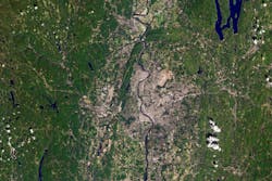
Currently, nearly 2,000 satellites are orbiting the Earth and the data is made available by public and private providers. LiveEO does not own any satellites but relies largely on public imagery, e.g. from the European Space Agency (ESA) which has optical and radar satellites in orbit. Each of the ESA’s satellites revisits a certain spot on Earth every five to six days and data can be downloaded within a short time period. With a spatial resolution of 10 m to 14 m (33 ft to 46 ft) and a coverage area of 10,000 km² (2.5 million acres) and 25,000 km² (6.25 million acres), respectively, both optical and radar imagery can be used to get an overview of the entire grid and to identify the regions that might need closer attention.
As radar imagery is independent of cloud coverage and daylight, LiveEO can provide these maps reliably every six days. As critical areas can be confined to relatively small areas, the company also integrates commercial, high-resolution satellite data to close any potential gaps in the spatial and/or temporal resolution by retrieving it from commercial data providers.
This data is fed into the algorithms, which combine it with satellite data to create models capable of automatically classifying objects in the areas of interest including the potential to cause damage. For example, trees close to overhead lines pose a varying threat depending on their species, state of health or age. These factors added to the amount and quality of the input data can improve the outcome of every analysis and can nearly reproduce reality with time and additional input.
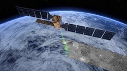
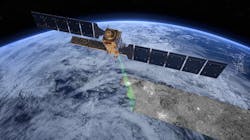
Fig.3. Orbit perspective.
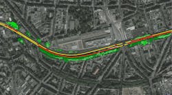
For example, the algorithms discern if sections of an overhead line routed through a dense forest encounter a clearing, or if the vegetation in close proximity to the overhead line consists of small bushes or large trees. They also identify the positions where vegetation is growing too close to the overhead line. The models are also able classify the composition of the vegetation surrounding the overhead line but different tree species pose varying levels of threat to the overhead line, which often needs to be factored into a risk analysis.
In addition to the focus on the interaction of utility overhead line networks with vegetation, the technology also assesses ground deformation and third-party interaction in the vicinity of the overhead line. By using radar satellite-based time series analyses, a vertical change in the height of the ground can be monitored to sub-centimeter levels and LiveEO works with change detection techniques to identify and classify relevant activities close to utility’s assets.
The models can be further extended to include real-time data on, e.g. traffic, construction works close to overhead line assets, local weather (wind, temperature, rainfall, etc.), ground-hydrological conditions or network usage and ground-proof data, thus delivering a holistic view on the condition of a utility network significantly improving risk models.
As LiveEO’s backend has to accomplish computationally intense, data-heavy tasks, the company is working with the cloud-based solutions offered by Amazon Web Services (AWS). However, the usage of this external service has been task and cost-optimized to only employ the resources only when really needed.
E.DIS Netz GmbH Pilot Project
LiveEO has demonstrated its capabilities as a result of signing a contract for the first pilot project with E.DIS, one of the largest regional distribution network operators in Germany. The utility supplies customers in an area of around 36,000 km2 (13,900 miles2) that extends from the Baltic Sea to Spreewald. The overhead line network comprises more than 5,000 km (3,107 miles) km of high-voltage lines, 27,000 km (12,428 miles) of medium-voltage lines and 47,000 km (29,206 miles) of low-voltage lines.
As part of the company’s digitization strategy E.DIS is looking for start-ups, whose technologies and solutions can add value and support in the on-going energy transition. Specifically, E.DIS recognised the potential of LiveEO’s satellite–based applications as an innovative solution for vegetation management and asset management. The pilot project involved the analysis of 12,000 km (7,457 miles) of overhead lines assessing the number of sections which were exposed to vegetation. The approach consisted of:
- Defining the thresholds
- Prioritizing, based on multiple criteria
Initially, the project team defined different values of the distance of the vegetation with respect to the overhead line network. Once the vegetation was classified according to the distances from the infrastructure, LivEO applied machine learning techniques to prioritize the "critical" sections, which constituted a potential threat because of the proximity to the overhead lines.
Results of the Pilot Project
E.DIS was able to benefit from the enhanced overview of the area while benefitting from the reduction in manual work. The subcontractors could easily identify more precisely the sections of the network exposed to the risk imposed by the vegetation and act accordingly. The prioritization of the tasks allowed infrastructure management to easily determine the budget for the different jurisdictions. The pilot project was completed in mid-2019 and following the successful validation of the analysis E.DIS intends to test the developed solution, which includes a workforce management tool with a satellite-data layer, and a customized front-end thereby taking an important step towards a digitized vegetation management process. The web app will enable management to view the entire above ground grid displayed on a screen and communicate with their sub-contractors through the mobile version. The toll does not only help to derive analytics and reduce the operational costs of the utility, it also represents new ways to predict risks and damages.
Additional Benefits Offered by Satellite Solutions
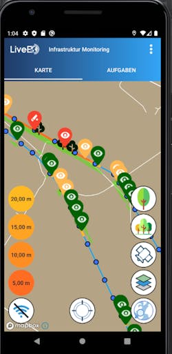
LiveEO translates the insights of the satellite technology into actionable insights in the form of an “Information-as-a-Service” platform. This enables the utility operators to interact with the data via a desktop-based web application and a mobile app. The web application can be used by the management and supervisors, e.g. to support them in their day-to-day business, budget and workforce planning or provide them with an overview of the asset integrity or work progress.
The product delivers essential performance metrics and supports data-driven budget, business and resource planning. This includes prioritization based on the assessment of criticality, recommendations for targeted inspections and the optimization of the tasks which have to be accomplished. Managers are also able to use LiveEO’s services to interact with field staff on site e.g. as data can be distributed to on-site personnel via the web and mobile app to improve efficiency and transparency of the workforce management. The mobile application is mainly used in the field to assist staff prioritize the tasks that have to be accomplished on-site and to allow input of user feedback, such as the upload of pictures or documentation. This facilitates communication and reporting, supports the tracking of maintenance progress while updating the backend analytics with new input to continuously improve the quality of the analysis.
LiveEO have work closely with the utility customer, providing training on the services offered and the identification of the requirements to be fulfilled by the analysis. This involves the spatial and temporal resolution of the results, the overall time frame, the nature of the potential threats to the utility network or conditions that have to be met to enable the use of the mobile app on-site. On completion of the analysis, the evaluation is performed in close communication with the customer as the industry-specific expertise cannot be replaced by algorithms.
Given the capabilities of the satellite technology, LiveEO will soon add vegetation health and height measurement capabilities to its portfolio. This will enable the measurement of tree heights, e.g. beneath overhead electric power lines, and to identify sick or dead trees that might pose a hazard to the integrity of a customer’s assets.
LiveEO is also setting its sights on wildfire and storm monitoring as a further important input in assessing the potential impacts to networks and will add the corresponding services to its vegetation monitoring product in the near future. Future integrations might also include data from airborne sensors, such as unmanned aerial vehicles (UAV) or pseudo-satellites which will add whole new dimensions regarding resolution and accuracy of the analyses.
Summary
The application of Earth observation for infrastructure monitoring has revealed an opportunity to replace tedious, time and cost-intensive work with a more efficient, accurate, frequent, economical approach. By combining the great potential of satellite data with high-quality expertise, it has become possible to offer an overview of the current state of thousands of utility kilometers to enable well-informed management decisions while reducing the volume of manual work on-site. This can result in the reduction of asset damage while delivering forecasts for the areas at risk in order to mitigate greater physical and economic damage.
About the Author
Nastasja Scholz
Nastasja Scholz ([email protected]) received her MSc in geophysics from the University of Karlsruhe in Germany in 2008 following which she was a Research Assistant at the McGill University in Montréal, Canada. In 2014 she was awarded a Ph.D. in Marine Geophysics with a focus on earthquake seismology, slope stability, submarine landslides and gas hydrates.by the University of Victoria, Canada, before joining the Technical University of Berlin in Germany as a Postdoctoral Researcher in Applied Geophysics. Since 2017, Scholz has been a Product Developer on Satellite Radar Data at LiveEO GmbH in Berlin.
Sven Mögling
Sven Mögling ([email protected]) was awarded a Master’s Degree in Business Management by the Otto-Guericke University, Magdeburg, Germany in 2005 and then joined Regiocom GmbH as a Team Leader and Project Manager (IT Systems and Customer Management) for Distribution System operator’s energy with a focus on Feed-In Management. In 2015, Mogling moved on to e.kundenservice Netz GmbH (E.ON Group) where his role was an Advisory for Processes and Projects and in 2019 he was appointed as the Innovation Manager with a focus on new technologies for energy networks by E.DIS Netz GmbH (E.ON Group).
