Editor's Note: Pacific Gas & Electric will be presenting on the topic of wildfire mitigation at T&D World Conference and Exhibition. Find more information here, see our conference program here and register for our event here.
Only in the last two decades has the word “wildfire” become synonymous with other catastrophic weather events, such as hurricanes or EF5 tornadoes. Multiple studies have found that climate change has led to an increase in wildfire season length, frequency, intensity and burned area. In California, historically, utility infrastructure has been responsible for less than 10% of reported wildfires, but with the changing weather and other factors, fires attributed to power lines from 2015 to 2020 made up nearly half of the most destructive fires in California’s history.
This alarming trend has electric utilities and distribution networks in California searching for better ways to prevent and prepare for future catastrophic events. Pacific Gas and Electric Co. (PG&E) is taking it one step further. In California and elsewhere, having a wildfire mitigation plan is more than just being prepared to manage wildfires.
PG&E is focused on not only preventing catastrophic fires in its service territory but also on sharing tools, technologies and lessons learned to help end utility-caused catastrophic fires. This approach is rooted in one of the company’s stands that “catastrophic wildfires shall stop.”
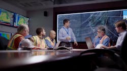
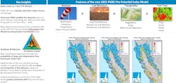
The fire science and wildfire mitigation team at PG&E are working with partners DTN, Technosylva, Atmospheric Data Solutions, Sonoma Technology Inc. and San Jose State University to develop and refine a machine learning fire potential index (FPI) model that predicts the probability a wildfire will spread into a large or catastrophic fire — even before a fire ignites. With the right insights, the team will be able to make operational decisions about the necessary actions needed to prevent a fire from ever occurring.
How FPI Works
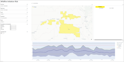
For years, wildfire response crews and utilities in fire-prone areas have vigilantly monitored environmental and weather factors to prepare and respond to changing conditions, but extreme fire behavior — fueled by long-term drought, warming temperatures and drier fuels because of climate change — have made forecasting wildfires and adjusting grid operations a critical task to mitigate risk. The FPI model represents the next evolution of fire prediction for PG&E. It deploys machine learning algorithms across more than 30 years of historical data sets of weather, fuels and historical fire occurrence every hour to determine the probability that fires will grow large, given current and forecast data.
“Historically, utilities had limited visibility to the actual wildfire risk on any given day and given hour,” said Nic Wilson, DTN product manager for weather risk. “With machine learning models and advanced analytics, utilities can take insights and decision-making further to reduce the risk of catastrophic fires.”
The development of FPI started in 2014, became operational in 2015, and continues to evolve as additional findings and data sets are discovered and developed. Finding the right combination of data sets and identifying causation proved to be challenging in earlier model developments.
A pivotal piece of the newer version was incorporating a 30-plus year data set of historical weather data provided by DTN, a global data, analytics and technology company. The FPI model would not be able to exist without this foundational data source that feeds into other models and the machine learning model.
PG&E also works with the other innovation partners to incorporate additional critical data sets within the FPI model, including dead fuel moisture — which is derived on an hourly basis and fluctuates based on temperature — humidity solar radiation and live fuel moisture data sets for multiple plant species in California.
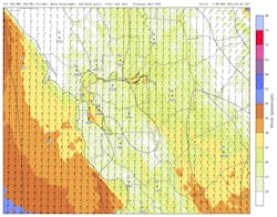
Terrain features and dynamic wind-terrain alignment also are important factors, computed each hour as part of the historical and forecast data to surface key planning insights. For example, the FPI model shows higher risk for winds perpendicular to terrain features compared to parallel. This perpendicular alignment occurs during Diablo and Santa Ana wind events in California and can lead to the downslope acceleration of winds.
The FPI model also is trained on historical fire occurrence data sets enhanced with fire detections from polar and geosynchronous satellites to provide sub-daily fire growth intelligence. When combined with hourly weather and fuel data sets, this enables the FPI model to learn, down to an hourly resolution, why or why not a fire may have grown over a short time frame.
Fortunately, DTN was already pioneering a faster global forecast delivery model than is the industry standard using high-performing cloud infrastructure, so the team knew that it could integrate this data quickly into its own cloud computing environments.
Other Variables
PG&E and the FPI innovation partners continue to evaluate other variables that may add more skill, such as different types of live plant species, soil moisture and weather model features. These data sets also are being shared with leading scientists from San Jose State University’s Wildfire Interdisciplinary Research Center (WIRC). WIRC continues to conduct active research and share results and findings with the community through peer-reviewed publications and directly with PG&E. These findings are then wrapped into new versions of the FPI model.
The plan is for utility and partners to continue working in tandem to bring the best minds, data sets and models to bear to achieve PG&E’s company stand that catastrophic wildfires shall stop.
Informed Decisions
While the success of the FPI model increases the confidence of wildfire probability forecasting, the PG&E team is always seeking ways to improve how the utility responds to all weather-related threats. The team and its partners are focused on two main things: Continuing to shrink forecast error and translating risk into operational decisions to mitigate that risk.
Blueprint For Prevention
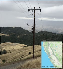
PG&E maintains 125,000 miles (201,168 km) of power lines, about one-third of them in areas with a high fire threat, but wildfires are not unique to California. Fires also burned at a record pace in other parts of the country, such as Alaska, New Mexico, Texas, Oregon and Idaho, bringing the number of wildfires and acres burned in 2022 higher than the 10-year average.
The PG&E team thought it important to share its work, as it was a community effort to improve wildfire mitigation. The group learned a tremendous amount from sister utilities in California who developed FPI models previously, and the feeling was it was important to pay it forward — in particular where doing so could help another utility create an operational model that can help them prevent a wildfire and save lives.
Many utilities have some data science expertise and computing resources available. With those resources, along with meteorologists, machine learning could be an option. If internal resources are not available to build a custom model, there are options available to partner with private weather companies like PG&E did with DTN and others.
“By working in cooperation with PG&E to identify the right input features and continuously refining the model, we are able to help them be successful, but our partnership will also help other utilities across the globe leverage machine learning and advanced analytics to develop their own version of a fire prevention model,” said DTN’s Wilson.
As wildfires continue to increase around the world, utilities are seeking methods to prevent and prepare for extreme events. One utility in California, with the help of innovation partners, has added another tool for reducing wildfire risk by fighting fire with technology. For PG&E, the FPI model is a dynamic blueprint for wildfire prevention that delivers on its statement that “catastrophic fires will stop.”
Scott Strenfel is a utility weather and fire weather expert and has been in a utility leadership role for a decade. He currently runs the Meteorology Operations and Fire Science teams at PG&E and is the Chief Meteorologist for emergency activations. Prior to PG&E, Scott worked at Sonoma Technology Inc., and researched the efficacy of satellite-based fire detection systems and modeled emissions from wildfires. Scott holds a B.S. and a M.S. in Meteorology and was one of the first graduates from the San Jose State Fire Weather Research Laboratory.
About the Author
Scott Strenfel
Scott Strenfel is a utility weather and fire weather expert and has been in a utility leadership role for a decade. He currently runs the Meteorology Operations and Fire Science teams at PG&E and is the Chief Meteorologist for emergency activations. Prior to PG&E, Scott worked at Sonoma Technology Inc., and researched the efficacy of satellite-based fire detection systems and modeled emissions from wildfires. Scott holds a B.S. and a M.S. in Meteorology and was one of the first graduates from the San Jose State Fire Weather Research Laboratory.
