NV5 Geospatial Unveils Cloud-Based Geospatial Platform
NV5 Geospatial, powered by Quantum Spatial, North America’s largest geospatial data firm, today launched INSITE, a comprehensive cloud-based platform that enables users to manage their geospatial data, from acquisition to delivery.
With applications designed for electric utilities and telecommunications, as well as federal, state and local governments, INSITE provides tools to support the entire geospatial data lifecycle, including project tracking, data collection and delivery, quality control, on-demand reporting, analytics and enterprise integration.
“Location-based data is critical for business and governments when it comes to managing risk, lowering costs, forecasting work and maintaining compliance. Yet there are numerous technical and organizational barriers that prevent them from optimizing use of this information," said Mark Abatto, president and COO of NV5 Geospatial. “INSITE was purpose-built to break down these barriers, creating a single source of truth for all geospatial data within an organization. Now, with INSITE, distributed teams can collaborate more effectively, visualize data with ease and gain real-time insights through powerful analytics.”
INSITE enables users to import, search, analyze, manage, integrate and export all types of geospatial data and multimedia.
As a cloud-based platform, INSITE improves speed and efficiency, minimizes storage expenses and supports greater collaboration by eliminating the use of standalone hard drives or a dedicated computer.
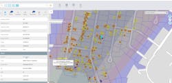
The INSITE platform is the foundation for three primary categories of use. All users can benefit from INSITE Lifecycle, which provides visibility into project status through a web-based map with real-time tracking of data from acquisition through processing and delivery.
INSITE Core enables data visualization and interaction, including access to aerial imagery, lidar data, GIS layers, and more. Lastly, INSITE provides the basis for Industry-specific applications, including:
· INSITE Facility, provides configurable asset management, including planning, execution, and tracking for inspections and maintenance on any asset and facility.
· INSITE Pole Manager, which enables electric utilities to take advantage of automated pole modeling analytics that support joint use, clearance, and integrity analysis programs
INSITE turbocharges use of geospatial data through integration with enterprise resource and asset management systems, such as Esri, IBM, Oracle, SAP, SPIDAcalc and others. Compatible with all major operating systems, INSITE is accessible via any Internet-connected device.
